Ok
This website uses cookies to enhance your ability to browse and load content.
More Info.
Quick links
Quick links
Queen's Archives Website
Catalogue home
About the catalogue
Search help
Privacy Policy
Language
Language
English
français
español
português
Deutsch
Clipboard
Clipboard
Clear all selections
Go to clipboard
Load clipboard
Save clipboard
Browse
Browse
Archival descriptions
People, Organizations, and Families
Archival institutions
Subjects
Genre
Digital objects
Search
Search
Global search
Advanced search »
Filters
Narrow your results by:
Subject
All
West End
, 1 results
1
Farmland
, 1 results
1
Low Altitude
, 1 results
1
Showing 24 results
Archival description
With digital objects
Aerial photographs
Advanced search options
Find results with:
and
or
not
in
Any field
Title
Archival history
Scope and content
Extent and medium
Subject access points
Name access points
Place access points
Genre access points
Identifier
Reference code
Digital object text
Finding aid text
Creator
Any field except finding aid text
Add new criteria
And
Or
Not
Limit results to:
Repository
City of Kingston Archives
International Hockey Hall of Fame
Queen's University Archives
W.D. Jordan Rare Books & Special Collections
Top-level description
Filter results by:
Level of description
Collection
Discrete Item
File
Fonds
Item
Part
Series
Sous-fonds
Sub-Series
Sub-sub-sub-subseries
Sub-sub-subseries
Sub-subseries
Subseries
Digital object available
Yes
No
Finding aid
Yes
No
Generated
Uploaded
Copyright status
Public domain
Under copyright
Unknown
General material designation
Architectural drawing
Artefacts
Cartographic material
Graphic material
Microform
Mixed media
Moving images
Multiple media
Object
Philatelic record
Sound recording
Technical drawing
Textual record
Top-level descriptions
All descriptions
Filter by date range:
Start
End
Overlapping
Exact
Use these options to specify how the date range returns results. "Exact" means that the start and end dates of descriptions returned must fall entirely within the date range entered. "Overlapping" means that any description whose start or end dates touch or overlap the target date range will be returned.
Print preview
View:
Sort by:
Title
Date modified
Relevance
Identifier
Reference code
Start date
End date
Direction:
Descending
Ascending
Add to clipboard
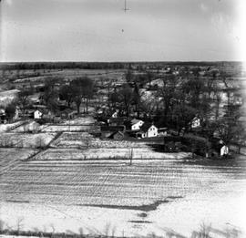
Wilton
Add to clipboard
Unidentified farmland (quarries), #15 Highway Quarries between Barriefield and Middle Road.
Add to clipboard
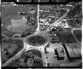
Traffic Circle
Add to clipboard
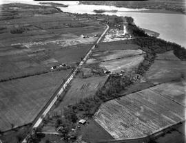
Simcoe Island, Horseshoe Island in rear.
Add to clipboard
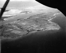
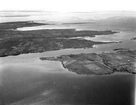
Simcoe Island and west end of Wolfe Island Farmland
Add to clipboard
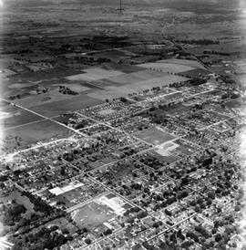
Shows Churchill School in bottom right - North to Alcan and west to Cataraqui.
Add to clipboard
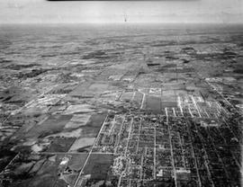
Portsmouth Ave. to Division St. / Palace / Water Tower / Aluminum Plant etc.
Add to clipboard
"Outer Station" - Montreal St.
Add to clipboard
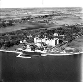
Ontario Hospital (Psychiatric)
Add to clipboard
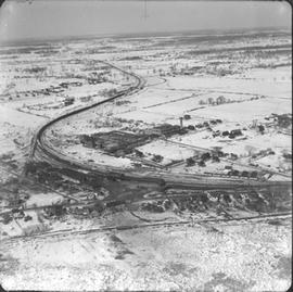
North Cataraqui Swamp, shows sharp rail curve and CN Station.
Results 1 to 10 of 24
Next »
1
2
3
Next »