- CA ON00239 F1411-S24-f5-17
- Item
- [ca. 1955]
Parte de Kingston Picture collection
Map of the City of Kingston with legend showing points of interest.
239 resultados com objetos digitais Mostrar resultados com objetos digitais
Parte de Kingston Picture collection
Map of the City of Kingston with legend showing points of interest.
Parte de Kingston Picture collection
City map of Kingston done as an aerial view showing where buildings and houses are located.
Pathfinder, Air Surveys Ltd.
Parte de Kingston Picture collection
Map of New France, 1703 by Guillaume De L'Isle. Scale is 1" = 150 miles.
Parte de Kingston Picture collection
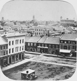
Item is a photograph of part of a stereoscopic view of Market Place looking west from the attic of City Hall. View includes P.McDonald, Grocer, wine and spirit dealer at 73 King Street; the Manchester Warehouse on King Street which was demolished in 1868 and E. Palmer, druggist and chemist at the corner of Market Square and King Street.
Notman, William
Parte de Kingston Picture collection
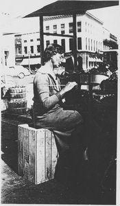
Item is a photograph of a view of Hilda Fearn, one of the Market vendors, knitting at her stall in the Market Square.
Parte de Kingston Picture collection
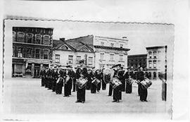
Item is a photograph of a view of cadet drum corps(?) on Market Square with Market Street in the background.
Parte de Kingston Picture collection
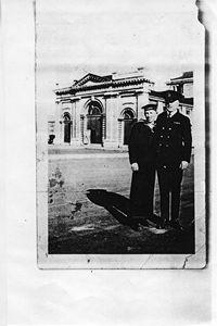
View of unidentified cadet and officer on Market Square with the back of City Hall in the background.
Parte de Kingston Picture collection
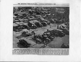
Photocopy of a photograph in the Kingston Whig-Standard which shows the Market Square taken from the roof of the Whig Standard Building. Some of the vendors stalls are identified including J.H. Keyes and E.H. Riley.
Bryant
Parte de Kingston Picture collection
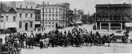
Photograph captioned "Market Square Kingston at Confederation, 1867".
Parte de Kingston Picture collection
View of the Kingston Fire Department in Market Square.