Lake Ontario, 1757.
Añadir al portapapeles
Map of Lake Ontario by Pierre Boucher de Labroquerie, copied by C. Pettigrew. Pen & ink tracing of original. Insets on map show Fort Ontario, Fort Choueguen, English fleet, Fort Niagara, French fleet, Fort Frontenac.
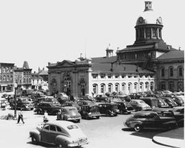
Market Square
Añadir al portapapeles
Series consists of images of market square in Kingston, Ontario.
Market Square
Añadir al portapapeles
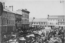
Item is a photograph of the Kingston Market Square filled with horses and wagons. View also includes Market Street and King Street.
Market Square
Añadir al portapapeles
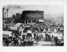
Item is a photograph of a view of Market Square filled with wagons. View includes the Crown Bank of Canada on King Street.
Market Square
Añadir al portapapeles
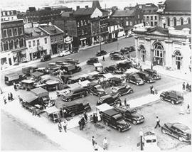
Item is a photograph of a view of Market Square filled with trucks and vendor stands, looking north across Brock Street.
Nagle, Kevin T.
Market Square
Añadir al portapapeles
View of Market Square in winter, some vendors are selling Christmas trees. View also includes Brock Street and the back of City Hall.
Nagle, Kevin T.
Market Square
Añadir al portapapeles
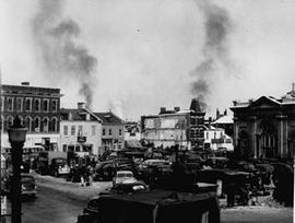
Item is a photograph of a view of Market Square, Market Street and the back of City Hall.
Nagle, Kevin T.
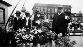
Market Square
Añadir al portapapeles
Five men, identified as Baker Brothers, Thomas Purdy and ? Purdy standing behind a flower stall at the Market Square.
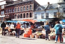
Market Square
Añadir al portapapeles
Item is a postcard of a view of some of the fruit and vegetable vendors at Kingstons Market Square. Inscribed au verso is "MARKETPLACE, KINGSTON, ONTARIO."
Thompson, Elizabeth
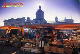
Market Square
Añadir al portapapeles
Postcard showing the vendors stalls at Market Square with City Hall in the background.